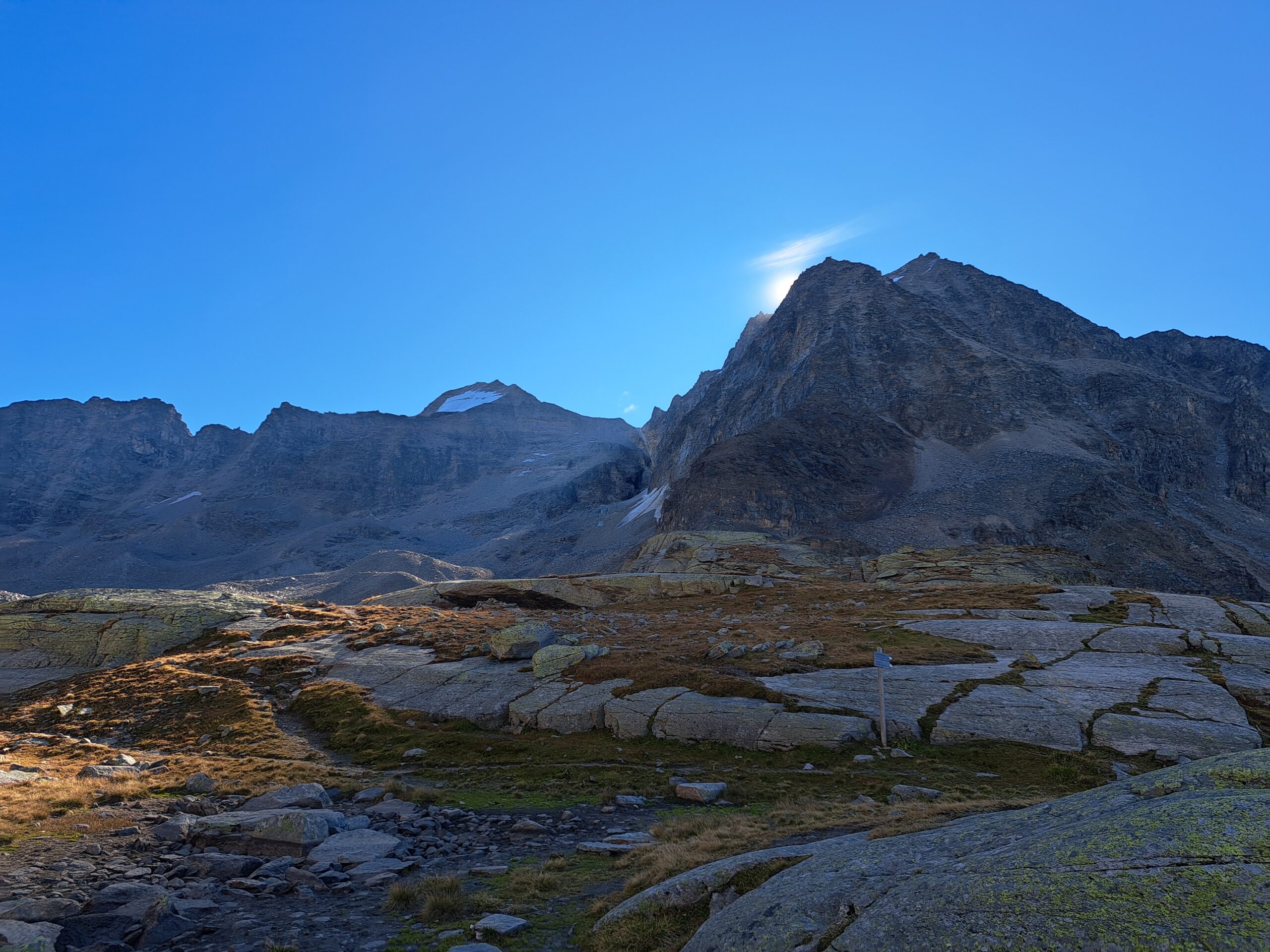
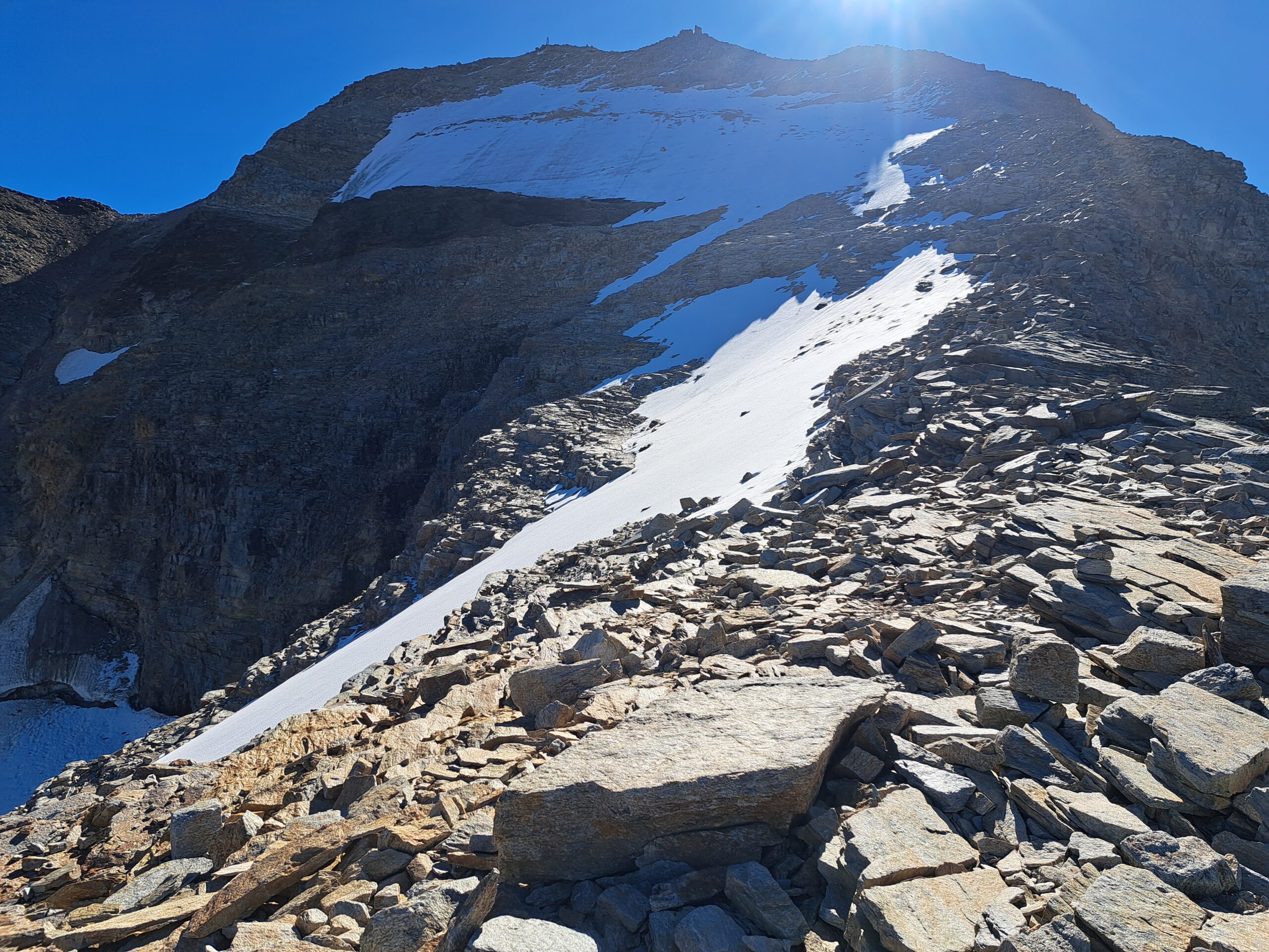
Hoher Angelus and Vertainspitze
Sulden
Italy
Friday, September 19: Back to the Alps
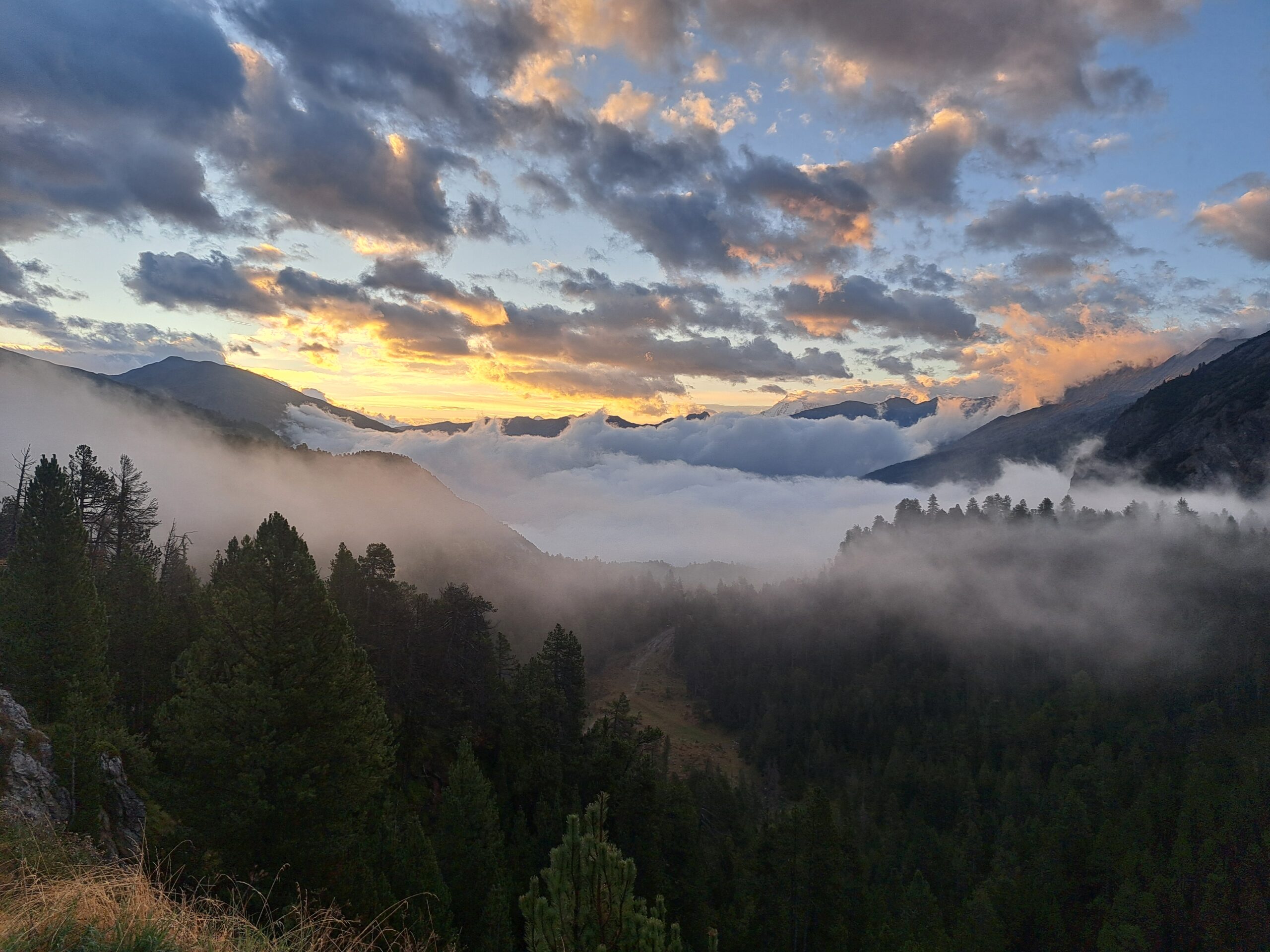
A week after returning to the Netherlands from the Alphubel climb, my next trip to the Alps is just around the corner. I’ve arranged with my mother to take her to the Dolomites and Graubünden region for a few days. My love of the mountains is certainly not a stranger… We booked a last-minute apartment in Sulden am Ortler, a village nestled between the two regions. On Friday morning, we drove south and, after a smooth journey, arrived in Switzerland. Via Basel, we drove past Zurich towards Chur, the capital of the Graubünden canton. From here, the motorways were over, and hours of mountain passes and back roads awaited us. We drove over the Fluela Pass and the Ofen Pass and were amazed at what a rugged and desolate area this is. No villages, no industry, just nature for hours! After this beautiful drive, we arrived in Sulden, and our mini-vacation could begin.
Saturday, September 20: The Tourist
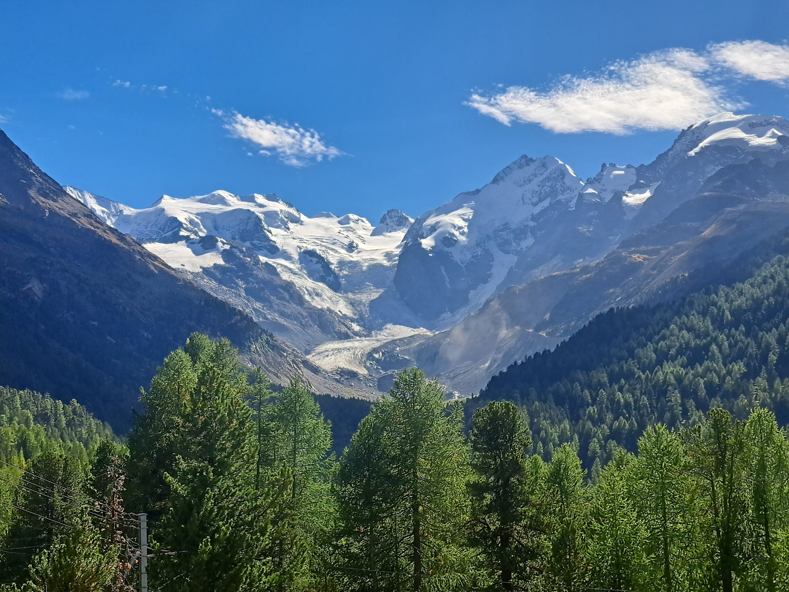
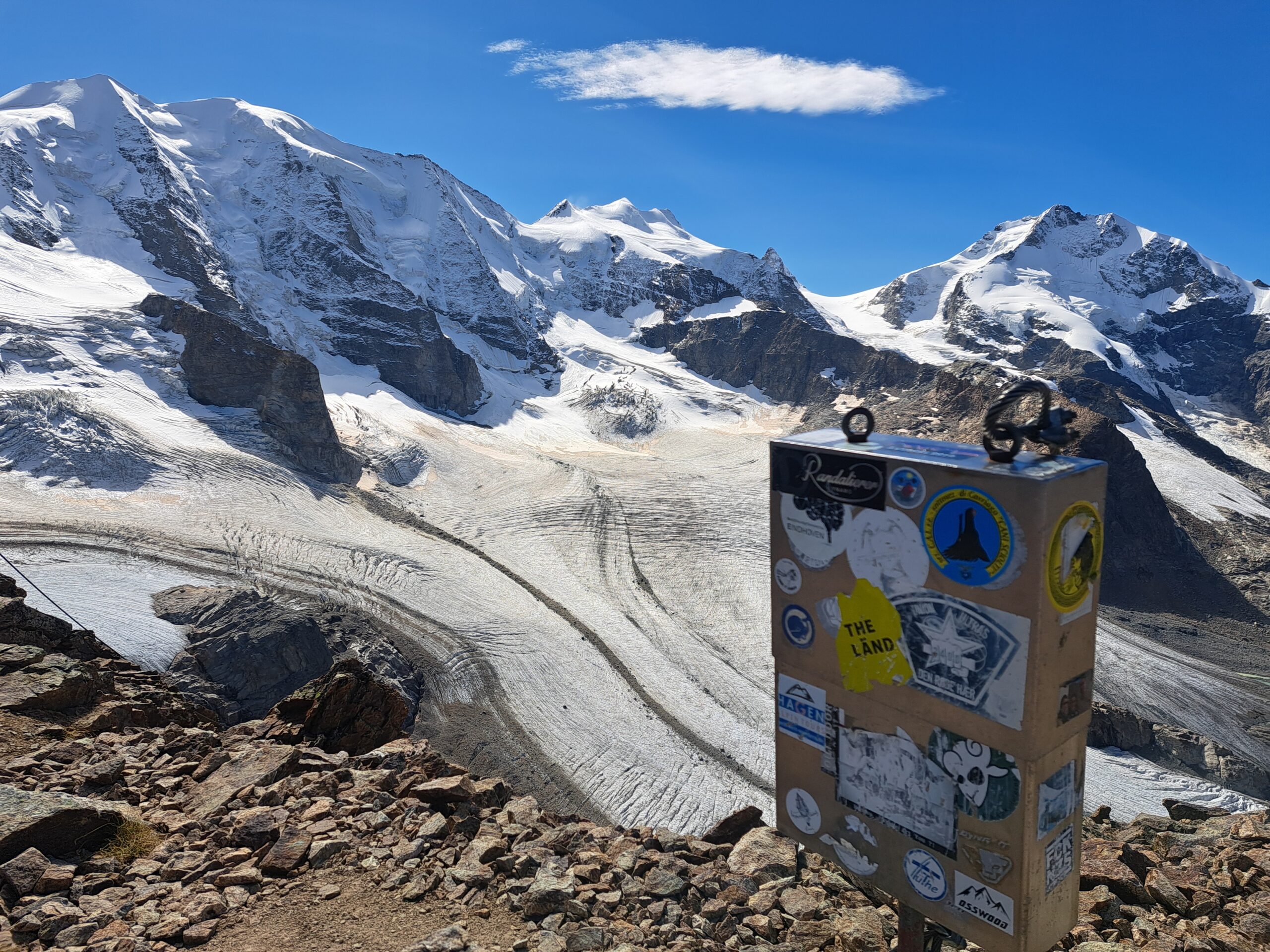
The next morning we start the day leisurely. We grab some rolls and after breakfast we go sightseeing. We drive up the magnificent Stelvio Pass through the Stelvio National Park and enjoy the view of the 3905-meter-high Ortler and the surrounding mountains. Then we continue towards the Bernina Pass to take the Diavolezza cable car up. At the valley station, the wind is already blowing hard, and when we step out at the top, it feels like the autumn storms have already started – what a wind! We have lunch at the Diavolezzahaus, and my mother decides to relax a bit in the restaurant. I go outside and see a rocky outcrop in the distance, the 3145-meter-high Piz Trovat. I check my phone to see if there’s a route leading to it, and indeed, there is. There’s also a via ferrata to the summit, but I skip it. I walk towards the summit and soon find myself at the top. The view of the mighty Bernina Massif remains phenomenal every time. Piz Palü, Bellavista, and the only 4,000-meter peak in the Eastern Alps, the 4,049-meter Piz Bernina. After taking some photos, I quickly ran back and, fun fact, I ended up second worldwide on this descent. We enjoyed a pleasant and relaxing rest of the day.
Sunday, September 21: The big traverse
Sunday morning I’m out of bed early again. Yesterday, my mother told me she was ready for a day of rest and that she’d like to read a book on the apartment balcony. I understand, of course; the past two days have been quite busy. I’d already looked around the area beforehand to see if there were any nice day hikes for me, just in case she wanted such a day of rest. I’d found the Hoher Angelus and Vertainspitze, two mountains over 3,500 meters high. Both mountains can be climbed via an alpine path; these are hiking trails for experienced hikers. Now, I don’t mind walking a bit, but I am, of course, a mountaineer. I’d read that there’s also a route that traverses both mountains. This makes the hike an alpine climb with a difficulty level of PD/PD÷. That sounds better! The route starts from the Kanzel cable car, past the Düsseldorferhütte to the Hoher Angelus. After the first peak, you descend to the Angelus scharte, a basin between the two mountains, and via the Laaser Glacier, you climb the Vertainspitze. The crux lies mainly in the scharte. A scree slope with a 40-degree steepness, offering no grip and with substantial boulders rolling along with you on the descent.
The total time for the route would be between 10 and 12 hours. You’d also normally spend the night in the hut, so you could start early. Oh well, we’ll see. If I don’t make it in time, I can always turn back.
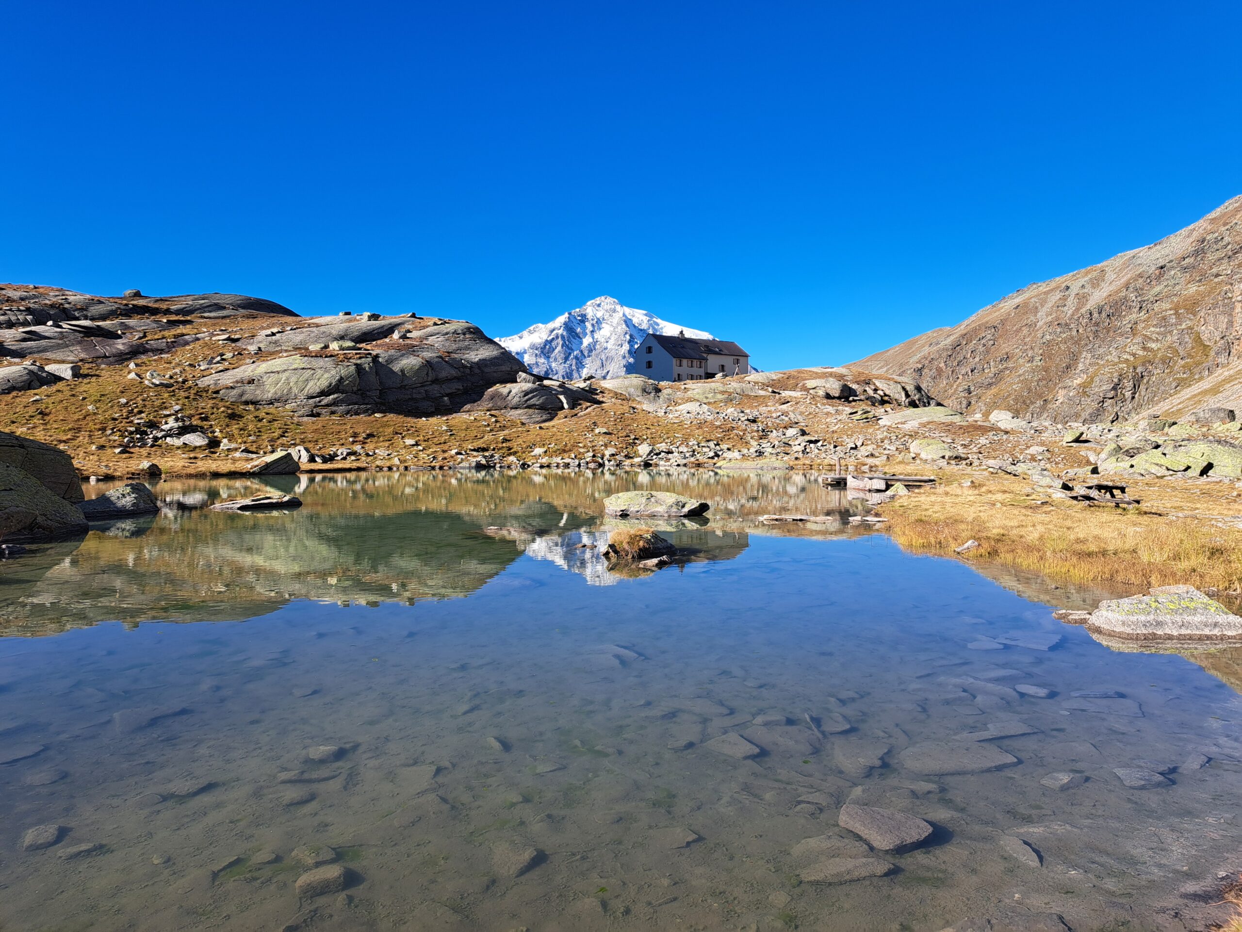
At 8:30 a.m., I hop on the first cable car and, once at the top, start my hike to the hut. Along the way, I have a phenomenal view of the Ortler massif. After 50 minutes, I’m already at the hut. Normally, it takes 1.5 to 2 hours, so I’ve already saved the first bit of time. The route to the Hoher Angelus is clearly visible from here, so I walk towards the ridge. Looking down, I always wonder: “How do you get up that mountain?” But, as always, it becomes clear again. The first part of the ridge goes vertically upwards and is secured with fixed steel cables. It’s not a via ferrata, so holding on to the cables is crucial. After the first vertical section, I see steel cables again higher up and continue climbing. But after a few meters, I can no longer see the cables. Damn, I climbed the wrong way! I assess the terrain and figure it’s doable without the cables. So, I climb the remaining vertical section more by feel, and I quickly get through it. Hiking trail? Where?
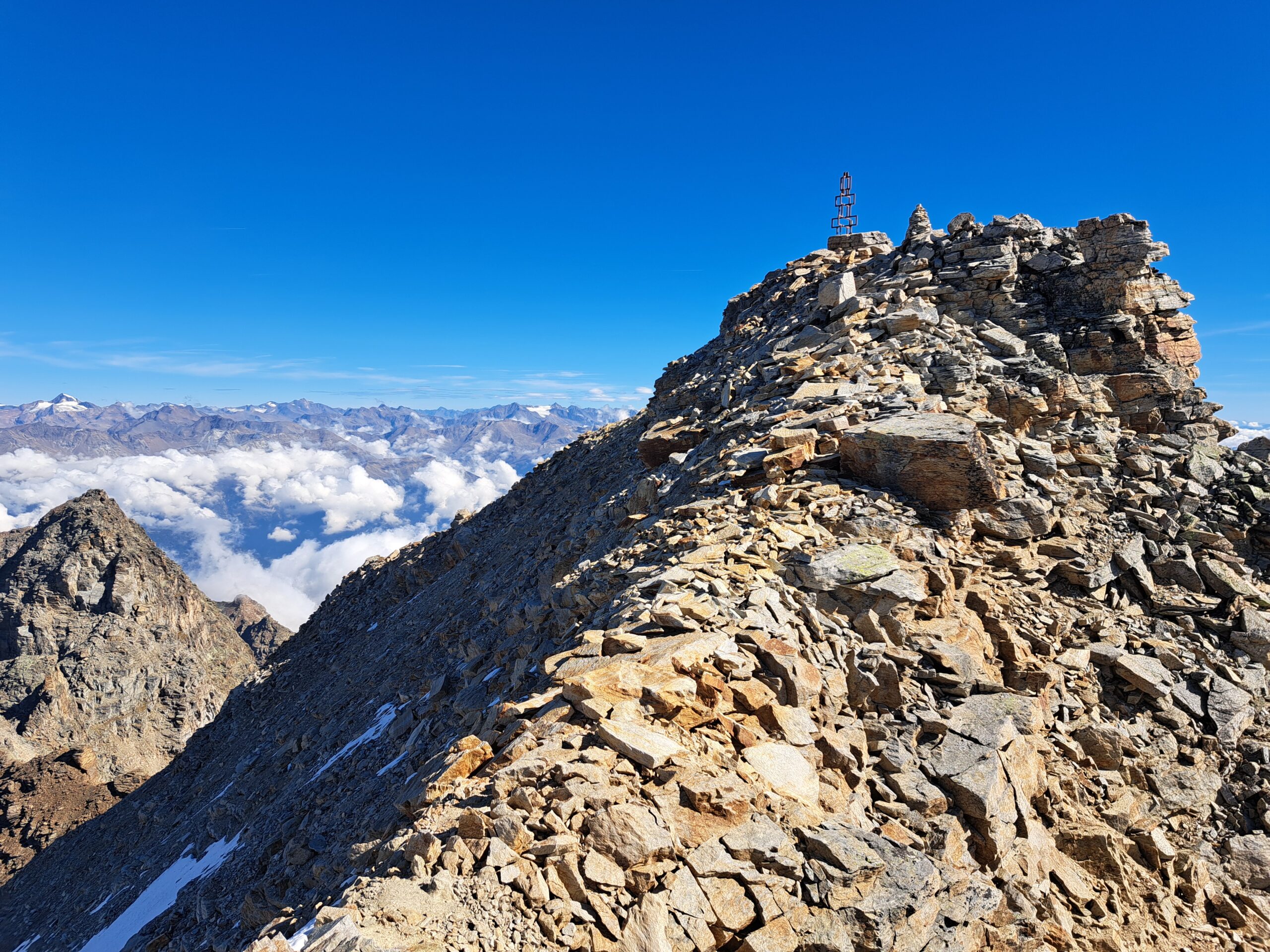
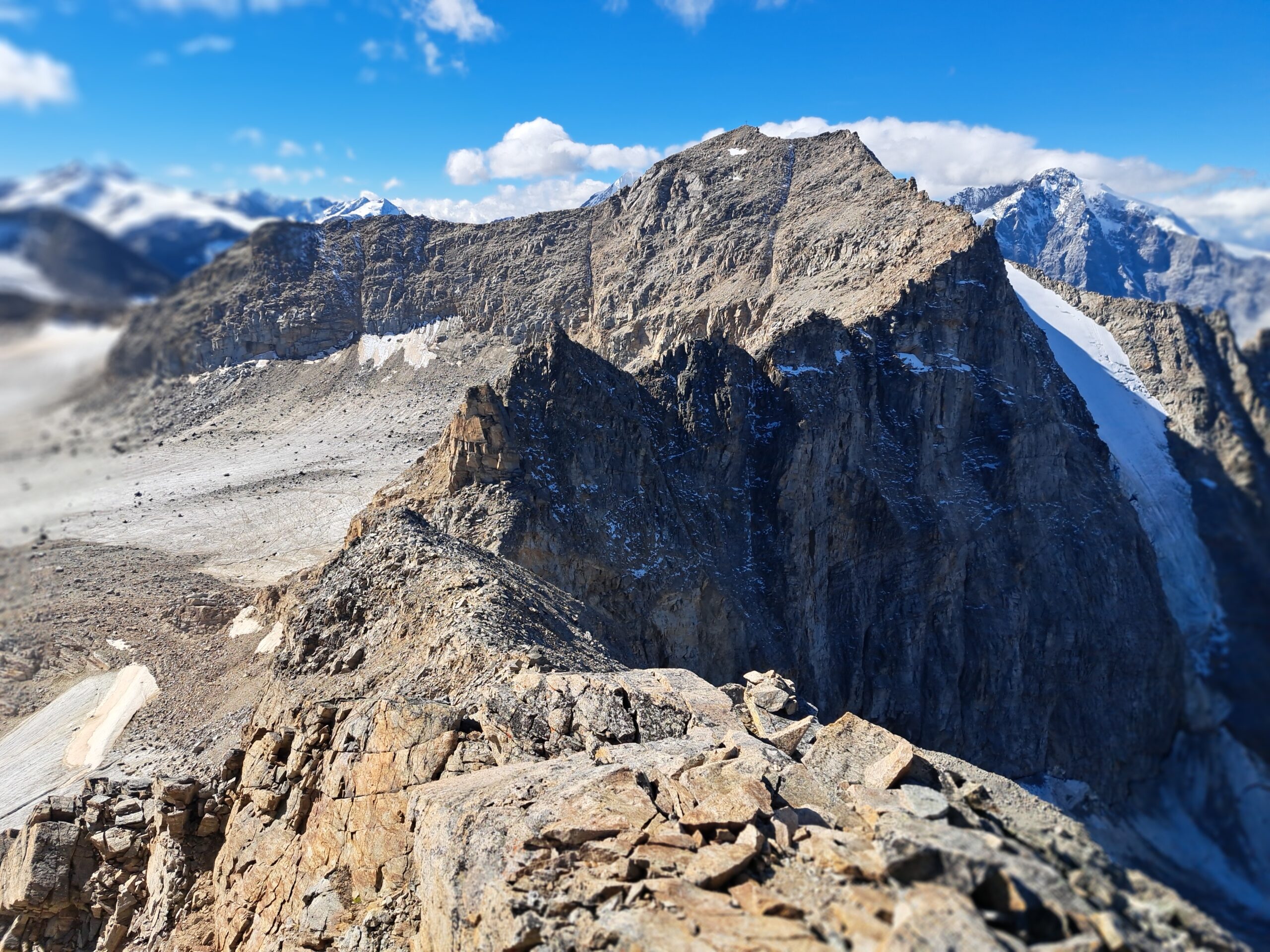
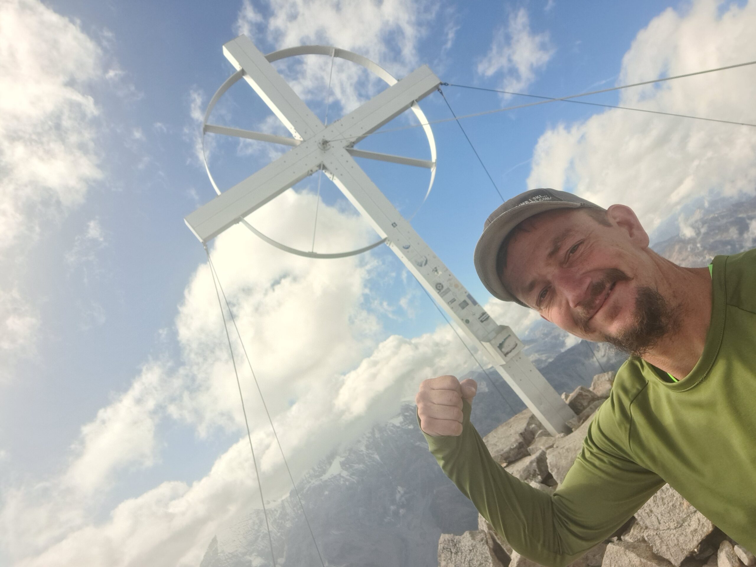
Now I’m on the summit ridge, which is much less steep. Here I have a fantastic view of my next destination, the Vertainspitze with its steep hanging glacier, and the King Ortler behind it. I walk towards the summit, and in just three hours from the cable car, I’m at the top of the 3,521-meter-high Hoher Angelus, or Angelo Grande. The summit cross looks like a playground climbing frame, so of course I decide to climb it too. I take some photos and videos and take a short break hidden behind a rock formation. The wind is blowing quite hard again today.
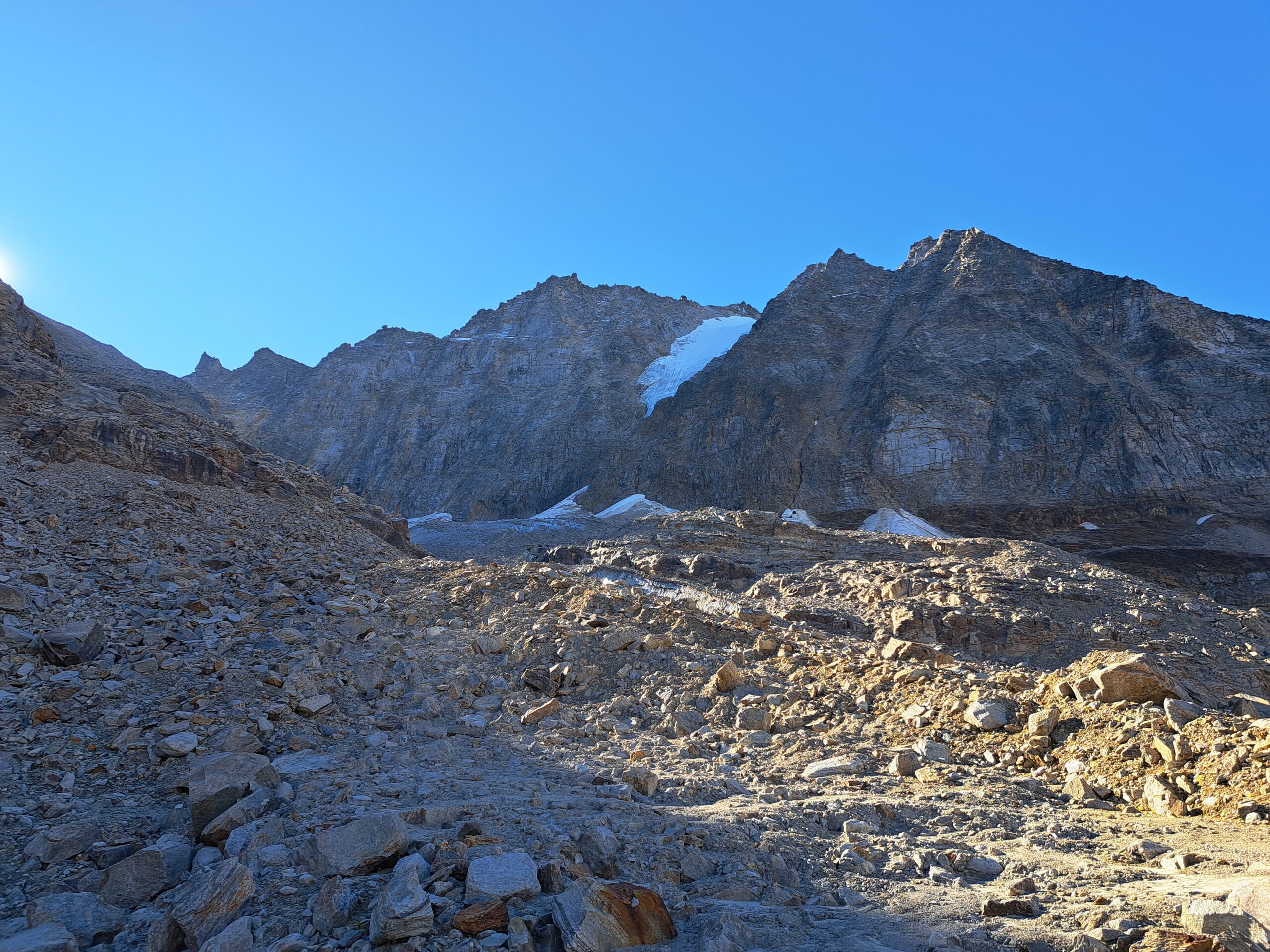
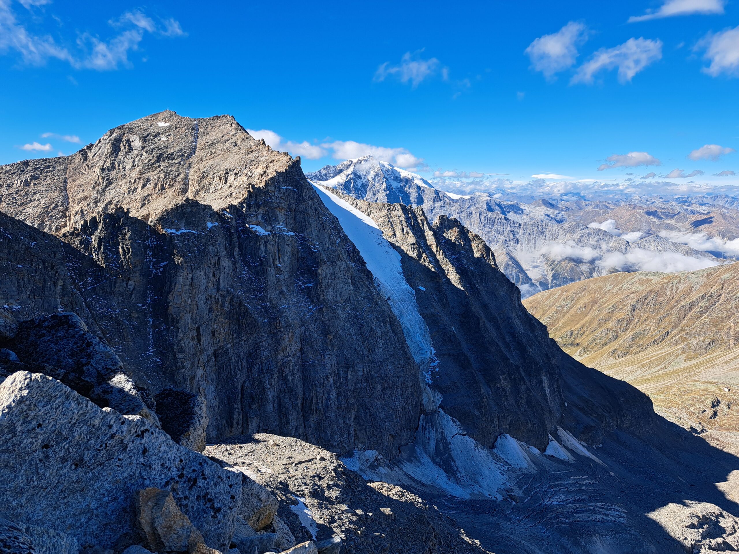
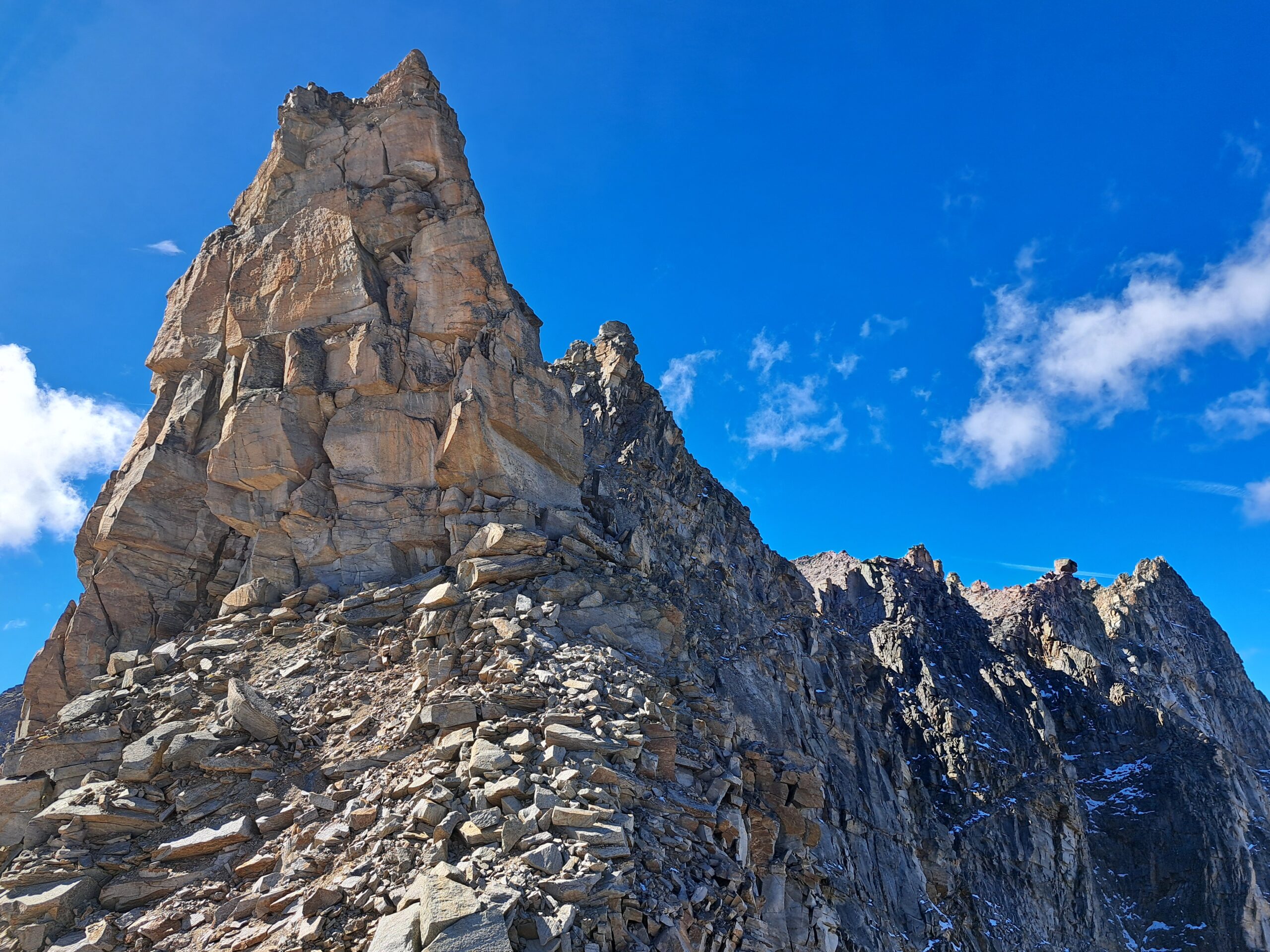
After a few minutes, it’s time to move on; there’s still a long way to go. I first descend a section of ridge I’ve climbed until I reach a fork. I keep left and climb down towards the scharte. Unfortunately, I soon encounter the terrain I absolutely hate. Above the scharte stands a gigantic, unstable rock tower, and below it, it’s a mix of scree and boulders. I scan the terrain for a route, but don’t see anything I like. In the description, I read that you should stay as far left as possible to avoid the rock tower. If that thing suddenly decides to fall… But all I see is a steep, sandy slope where descending will be a huge slide. Below the rock tower, I see large blocks where I can find more grip. I take the risk and descend below the tower as quickly as possible. It’s a bit slippery here too, but luckily I get through it quickly. I head straight for the Laaser Glacier, out of this mess! At the foot of the glacier, I take a breather.
I look towards the Vertainspitze and see people already walking towards the summit. I haven’t met anyone on this route yet, and after this descent from the scharte, I understand why. It’s time to get back on my feet. I jump over a fast-flowing stream onto the ice and walk towards the next mountain. To reach the route, I have to go on the other side of the mountain. Fortunately, the glacier is almost free of snow, so I can see the crevasses. After the relatively flat section, the glacier now climbs steeper towards the next scharte, which I have to climb. I wonder if I shouldn’t have brought my crampons. It gets steeper and steeper, and without them, it’s difficult to maintain grip. Fortunately, there’s a thin layer of fresh snow on this section, and I have some grip there. At the top, I’m standing in front of the scharte, another pile of rubble. Luckily, it’s only a few dozen meters up. I grab as many large boulders as possible and pull myself up. This feels more like doing pull-ups at the gym than climbing, but it works. I scramble through as quickly as possible and climb the ridge; the difficult part is over.
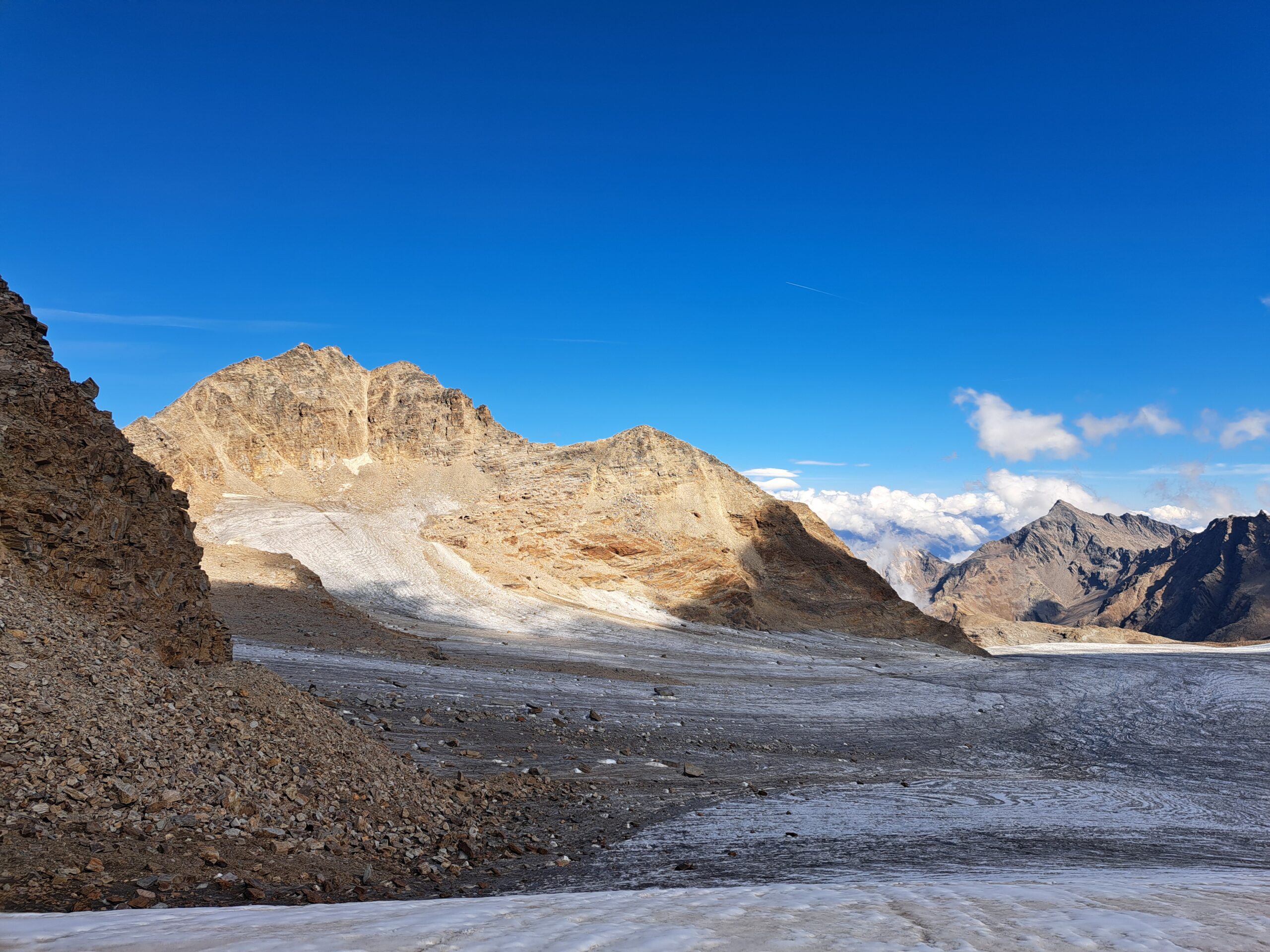
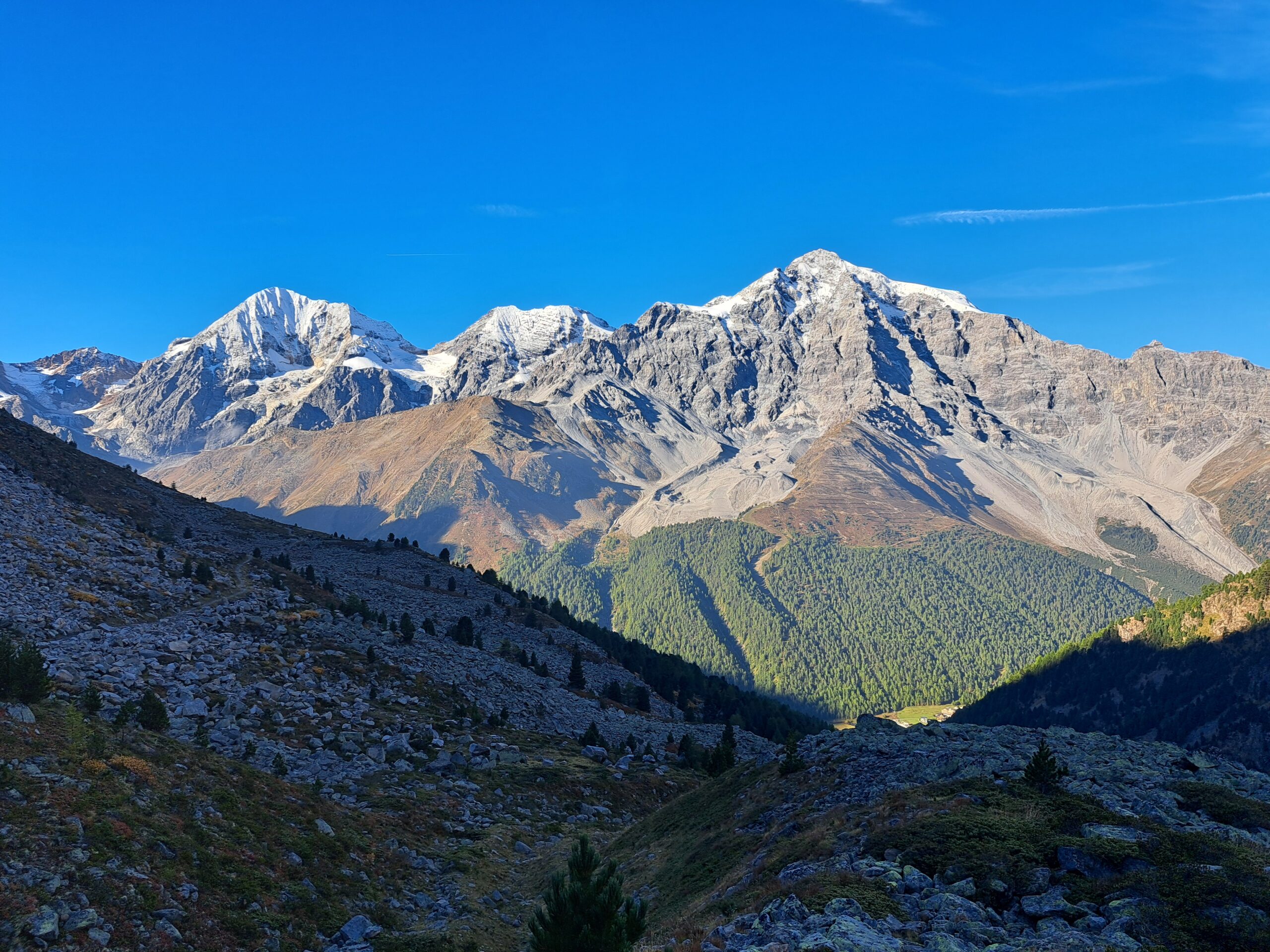
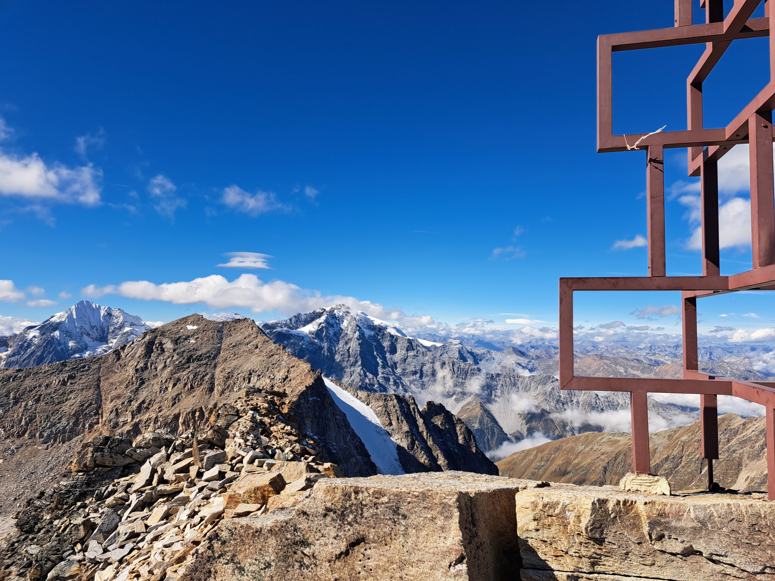
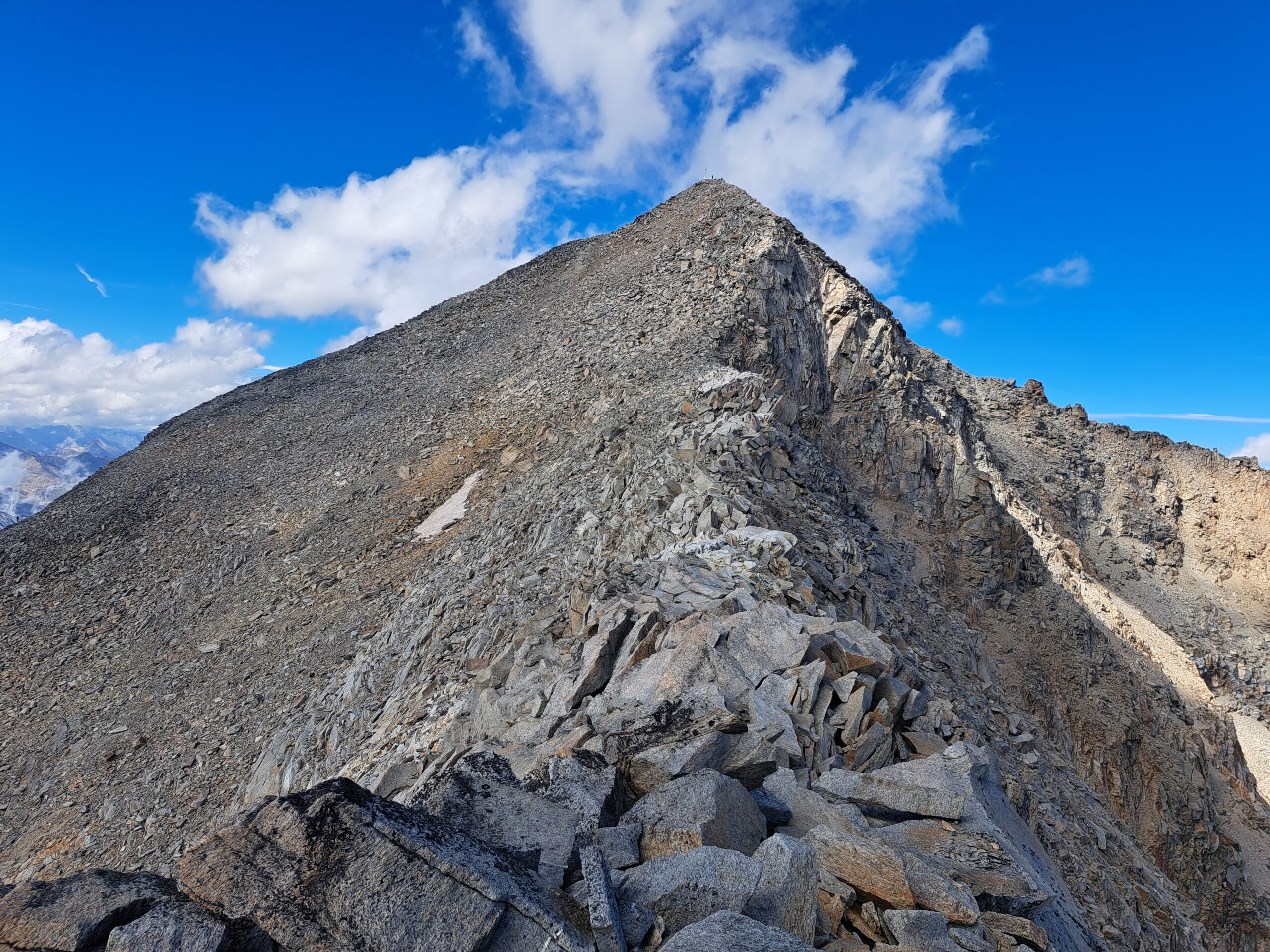
In the distance, I see the summit, but first, I take a short break. I eat a power bar and drink something, but the biting wind quickly chills me. So, it’s time to get moving again. I walk along the ridge towards the bright white cross. I decide to stay on top of the ridge instead of the route just below. It’s more fun climbing with short vertical sections, and I’m in the sun. And then, after five hours of climbing, I reach the second peak of the day, the Vertainspitze or Cima Vertana, at 3,545 meters. Once again, I’m rewarded with a magnificent view of the Dreigestirn: Ortler, Monte Zebrù, and Gran Zebrù. I climbed the 3,850-meter-high Gran Zebrù years ago; it’s also a beautiful mountain. But I also see the weather changing; more and more clouds are moving into the valley. Time to descend. The cable car is open until 5:00 PM, and when I started today, I was worried about making the last lift. If I didn’t make it, I’d have to descend an additional 450 meters and would be late back in the valley. Fortunately, it was still early, so I began the descent with peace of mind. I descended the ridge towards the Rosim Valley and soon saw the Kanzel cable car’s mountain station. I jumped in, and once I reached the bottom, I drove back to the apartment. From now on, the climbing was over, and my thoughts returned to the topic of “tourism.”
Get In Touch
Ready to embark on your next adventure or looking to enhance teamwork and cooperation within your organization through exhilarating experiences? Feel free to contact us. We’d love to discuss how Bart Van Bemmel’s expertise in mountaineering and extreme sports can create unforgettable journeys and valuable lessons tailored to your needs. Get in touch today to start your unique adventure or team-building experience.